- Submit News
- 501-666-6726
- [email protected]


World Health Organization says, Processed meats cause cancer
October 26, 2015
One Belizean American View of Election 2015 in Belize
October 26, 2015
Posted: Monday, October 26, 2015. 2:24 pm CST.
Monday, October 26th 2015. BMG: As Mexico breathes a sigh of relief having sustained little damage from one of the strongest hurricanes ever recorded in the Western hemisphere, we are reminded just how the world is at mother nature’s mercy. Hurricane Patricia, being a category five storm, was expected to cause mass damage and lead to many problems for Mexico including massive flooding.
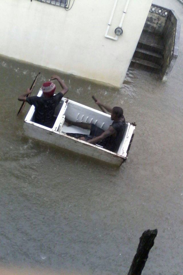
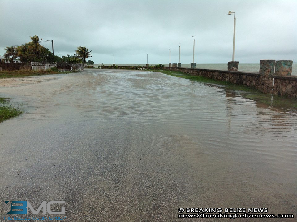
In fact, just last week, Belize itself was given a reminder of the damages floods can cause. Those floods, however, were the result of a regular passing, low-pressure system; not even a tropical depression. Yet, many homes were significantly damaged, some collapsed, emergency rescues had to be deployed, shelters were opened and the government responded with urgency.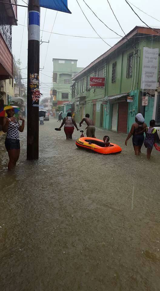
The unfortunate natural occurrence, like many other things in the country, managed to find its way into political debates about proper drainage, or rather lack thereof, in the country.
Critics of the government have argued that enough resources weren’t dedicated to constructing proper drainage measures during the infrastructural renaissance, which the current administration undertook. Government supporters have rebutted that because, according to them, Belize is below sea level and the government cannot control the weather so flooding is perfectly natural and the government should not be held directly accountable.
There are valid components in each argument, which must be considered when objectively evaluating Belize’s drainage problems. Indeed, Belize is below sea level and prone to flooding, however, it doesn’t mean that there aren’t methods available, which could mitigate such flooding. Yet, no amount of infrastructural development and dedicated resources to such development could ever guarantee 100 percent effectiveness.
The 2012 Belize City Master Plan financed by the Inter-American Development Bank (IDB) under the Japanese Trust Fund, which the Mayor often references when explaining the method to street concreting, addressed some of these drainage issues.
That report gave some insight into Belize City’s current geographical landscape and the methods necessary to properly drain water into the ocean.
It explained that early in Belize’s history, much of the land between the coast and the Belize River may have been mangrove wetland and mechanical pumping provided the means to drain the swamps and wetlands to confine water to constructed channels. As this settlement pattern and spatial structure has historically developed at this location, Belize City has become more vulnerable to flooding, inundation and possibly ground instability and sinking.
The settlement pattern and the subdivision of land for habitation have not left enough physical space for the volumes of water that are always present in a delta landscape such as those in Belize City. This suggests that coastal and river wetlands are fundamental to protect Belize City from flooding. Yet they are being lost quite rapidly. Therefore, a fundamental component of a strategy and water plan must be the preservation and conservation of these wetlands.
An existing land use strategy characterized by the reclamation, draining (mechanical pumping) and subdivision of the city’s mangrove swamps and soggy areas (Belama, London Bridges, Chetumal Street, etc), may have had an unexpected impact in causing some ground levels to fall, the report said. In various areas of the city, such as along the highways, falling ground levels and sinking homes can be observed.
 This sinking can be occurring through different mechanisms. For example, the removal of the mangrove swamps may have brought an end to soil recreation through organic decomposition. If this hypothesis is correct, the city may be surrounded by low lands with falling and sinking ground levels. Under such circumstances, Belize City and its low lands, no longer slope toward the city’s natural drainage outlet (the sea), water no longer flows downhill in Belize City, and the city may not be drained by gravity. Therefore, the report then goes on to advise, it has to be drained mechanically pumping it from low lands up to higher ground and out of the city. Levees along the river and the sea are also needed to protect these low lands against the risk of flooding and inundation.
As Belizeans begin to inhabit the mangrove swamps, mechanical pumping and constructed drainage channels are needed to remove water from the soggy ground. Land has been subdivided to create as many saleable parcels as possible, and storm water was conveyed to the sea through a series of canals, some at or above grade; open canals, and others below ground (underground drainage).
The increasing need to pump water out of Belize City is the direct consequence of this settlement pattern, spatial structure, and land use strategy; the continuous draining and developing in the city’s back-of-town mangrove swamps. As mentioned above, drying out the swamps may cause the ground to subside. As the land falls lower and lower, it becomes more vulnerable to flooding, and water no longer drains naturally to the sea. Levees need to be built to protect the falling lands from inundation, and pumps become necessary to lift the water to higher levels, the report reiterated.
If all of the water that falls in the city and its low lands must be removed from the city by mechanical pumping, it follows that the city will become dependent on levees and mechanical pumping stations to remove all the water that falls in these low lands, from drains and sewers up to higher grounds. Yet even if this were the case, this mechanical drainage system can only operate at a certain capacity.
Belize City may still be prone to flooding. Often heavy rains cause rapid water accumulation in the city, which discharges at lower rates. It is probable that Belize City’s low grounds could not be adequately drained mechanically because pumps and levees could fail in conditions of extreme weather events such as strong storms. Because parts of Belize City are lower than the water around it, its perimeter must be protected by a series of flood-walls and earthen levees.
These barriers may take different form at different locations along the city’s edge. They would require constant, vigilant maintenance. During Hurricanes, the storm surge often overtops and undermines these levees and flood-walls at Belize City’s boundaries and along its drainage system. Catastrophic flooding may then result.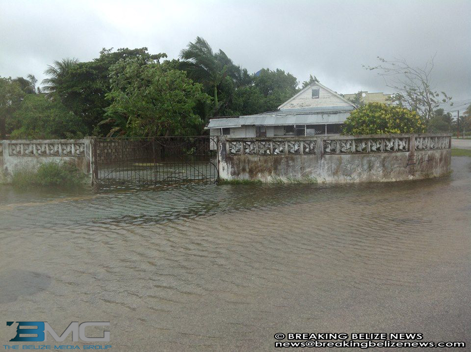
This combination of circumstances, the Master Plan said, demand a new approach to water in Belize City, one that recognizes and adapts to the dynamic ecology of Belize City’s location between the Belize River and the Caribbean Sea, in the Belize river’s delta.
The recommended approach to water management to avoid flooding as a natural disaster has two main components. The first component leverages Belize City´s river and coastal wetlands, its ecosystem services, and the concepts of multifunctional eco-infrastructures with networks of green and blue spaces, as the main tools to address the connectivity of these ecosystems and wetland-scapes. The component advocates their protection and the provision of ecosystems while also addressing mitigation and adaptation to climate change. The second component of the approach is the water plan.
The plan advises GOB to undertake several investment projects along with the development of the eco-infrastructure. That eco-infrastructure would essentially protect the integrity of Belize’s wetlands and facilitate mineral growth, which would in effect re-soil the land and mitigate the sinking-land phenomenon.
It recommends GOB adding a super-levee along the coastal waterfront, which would substantially improve flood protection. This levee ,crowned with a mangrove forest, would be built not on top the existing levee (the one running from the river mouth to almost the house of culture), but just offshore of it in the Southside, where Collet Canal meets the Caribbean Sea.
The levee would enable the development of a majestic coastal side boulevard, with numerous palm trees, lawns, parks, and small harbours and marinas (including a new cruise terminal), as well as space for new, mixed development: hotels, restaurants, shops, condos and other housing.
It would supply what the Latinos call ‘el placer de vivir’, giving new life to the seafront, and give Belize City, a new, usable waterfront connected to the riverfront through the new Collet Canal multifunctional park and public open space.
Between this new levee and the existing levee we could imagine a new mangrove forested wetland, acting as a bio-filter and safety valve, where rainwater from nearby neighborhoods would be stored and treated, the report said. The wetland will improve the city’s water quality. The wetland would form a buffer; there may be opportunities to use the buffer as a water source for internal water circulation during dry periods.
It also recommended that adding new islands to the coastal waterfront would create a platform to absorb and lessen storm and wave energy. In the same manner as Venice’s Lido, such islands would break the waves and create a quiet, shallow lagoon between the existing waterfront and the new islands. The islands could also become platforms for nature, recreation, fishing, picnicking, and connected to the main land by ferries, water-taxis or even by bridges.
New beaches along the river and the sea waterfronts are important components of protection and safety infrastructures. The importance of these beaches cannot be overstated. In addition, the beaches’ sandy soil and slightly elevated position would make them excellent places to live, to work and to develop in their proximity, according to the Master Plan.
Redeveloping existing canals with circulating water is important for adding new water storage. Additionally, small, grassy culverts that absorb water during heavy showers and then drain naturally, would add new water storage. The hidden and degraded canals should be transformed into proud waterlines, lined by native trees and vegetation, the report advised.
Collet Canal should serve as an example of how to transform these degraded infrastructures into aesthetic structures and area, and enable a more effective water management and water storage strategy. The canals would also give structure and identity to their neighbourhoods. The Canals system’s vigor, moving water, its aquatic plant and fish species balance/health will mitigate mosquito/pest concerns. Collet Canal would become part of Belize city downtown’s front yard with a welcoming nature to the downtown. The canal’s brackish water would be replaced by freshwater and the reinvented canal will add a new green buffer into the area’s new, dynamic water system.
Creating new canals will increase water storage capacity and enhance the water system, and also creates a new urban feel, new development possibilities and enhanced atmosphere to Belize City, as per the Master Plan. Creating more space for water in the areas around the London Bridges is also important for adding new water storage. Belize City’s London bridges could be developed into a little Venice and a little Vietnam, with cozy family-restaurants, floating houses, floating gardens, urban agriculture-fields etc., it added.
This would add to Belize City’s appeal as an international culture and sustainable tourism destination showcasing its cultural diversity. Creating a circuit that connects the river front, the Bourdon reserve, Krumman Lagoon, the canals, and the seafront is also important for adding new water storage. During the wet months and during major storms, these large parks could store more water. By linking these large ecosystems and blue and green spaces, the city can improve its natural urban canopy and add water storage at the same time.
New or expanded freshwater wetlands west of the city including Krumman Lagoon and Bourdon Reserve will reintroduce nature to the edge of the city. This will add a new dimension and new opportunities to the city. Recreational opportunities would include fishing and bird-watching.
 It also said Central American Boulevard should be redeveloped and revitalized as an attractive area to live and work, functioning as a proper Belize City boulevard, with a central canal, covered by broad trees creating a green umbrella. Native trees should be planted along Central American Boulevard to give shade, character and charm to it. Such trees reduce summer heat stress and absorb surplus surface/ground water in low-lying areas. New proposed public squares/spaces in Central American Boulevard should also receive such plantings, giving the entire area a feel similar to a public garden.
The Master Plan also said it is important for GOB to select some of the most vulnerable neighborhoods in the city to flooding from the river, the sea and from rainfall, which occurs frequently, as well as those vulnerable to social and economic decay, related to a lack of spatial quality. An important goal is to address flooding, reduce flood risk while making these neighborhoods more attractive, by improving the spatial quality of their urban environment.
GOB along with the IDB has undertaken a flood mitigation project, which has seen the construction of an underground canal underneath Douglas Jones running under Cinderella Plaza, Baymen Avenue, Calle Al Mar and out to the sea. The plan advises more work to be done all across the City.
So while Belize does happen to be flood-prone, there are infrastructural and environmental methods to mitigate the effects. The Dutch have dealt with below sea-level flood related problems for centuries and have well-trained consultants available. So while debate rages over who is to blame or who not to blame; the simple fact is: there are options.
Advertise with the mоѕt vіѕіtеd nеwѕ ѕіtе іn Belize ~ We offer fully customizable and flexible digital marketing packages. Your content is delivered instantly to thousands of users in Belize and abroad! Contact us at mаrkеtіng@brеаkіngbеlіzеnеwѕ.соm or call us at 501-612-0315.
© 2015, BreakingBelizeNews.com. Content is copyrighted and requires written permission for reprinting in online or print media. Theft of content without permission/payment is punishable by law.


Comments